
The W1 Neighbourhoods Explained: Mayfair, Soho, Marylebone, Fitzrovia and More
Ask anybody to explain the W1 London areas and you will get a list of famous names, Mayfair, Soho, Marylebone, and no explanation of where one stops and the next begins. The postcode is the clearest answer available, because W1 is not one district but thirteen, and each of them maps fairly closely onto a neighbourhood people already recognise.
This page sets out all thirteen: what each covers, which council runs it, and the handful of boundary rules that decide whether an address is really in W1 at all. If you are renting, buying, registering a business or arguing about a parking permit, the letter after the 1 is the part that matters.
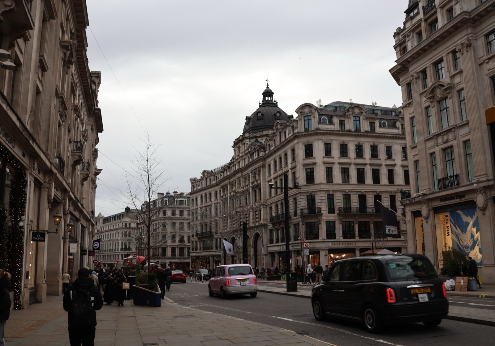
Regent Street, the spine that separates Mayfair from Soho. Regent Street, London (January 2024) by DiscoA340 (CC BY-SA 4.0), via Wikimedia Commons.
The thirteen districts
Twelve of these are geographic. One, W1A, is not.
| District | What it covers | Council |
|---|---|---|
| W1A | Non-geographic. PO boxes and large users across W1 | n/a |
| W1B | Regent Street and Portland Place | Westminster |
| W1C | Oxford Street, western stretch | Westminster |
| W1D | Soho south-east, Chinatown, Soho Square | Westminster |
| W1F | Soho north-west, Berwick Street | Westminster |
| W1G | Harley Street and the medical district | Westminster |
| W1H | Marylebone, western side | Westminster |
| W1J | Mayfair south, Piccadilly | Westminster |
| W1K | Mayfair north, Grosvenor Square | Westminster |
| W1S | Mayfair east, Hanover Square, Savile Row, the Royal Academy | Westminster |
| W1T | Fitzrovia and Tottenham Court Road | Camden |
| W1U | Marylebone, around the High Street and Wigmore Street | Westminster |
| W1W | East Marylebone, Great Portland Street, western Fitzrovia | Westminster |
The 2000 recoding, and the codes that no longer exist
If you have ever found an old letterhead reading W1V or W1Y and wondered why nothing recognises it, this is why. Royal Mail recoded W1 in June 2000, retiring W1M, W1N, W1P, W1R, W1V, W1X and W1Y and replacing them with the current lettered set. The geography barely moved; the labels did.
The practical consequence is that any address database, delivery system or insurance quote will reject the old codes outright. If you are buying a leasehold flat and the historic paperwork quotes a retired code, that is normal, not a red flag.
The four neighbourhoods people actually mean
Mayfair: W1J, W1K, W1S
The square bounded by Oxford Street to the north, Regent Street to the east, Piccadilly to the south and Park Lane to the west. Three postcodes split it: W1K for the northern half around Grosvenor Square, W1J for the southern edge along Piccadilly and Berkeley Square, and W1S for the eastern side taking in Hanover Square, Savile Row and the Royal Academy.
It is the least residential of the four. Much of the housing stock is either very large or converted to offices, and the streets empty markedly at weekends. Our Mayfair property guide goes through what that means for buyers.
Soho: W1D and W1F
Between Oxford Street, Charing Cross Road, Shaftesbury Avenue and Regent Street. W1D covers the south-east, including Chinatown around Gerrard Street and the area around Soho Square. W1F covers the north-west, around Berwick Street and Broadwick Street.
The eastern boundary catches people out: cross Charing Cross Road and you are in WC2, which is Covent Garden and a different world for licensing and parking. See our Soho guide and the Chinatown guide.
Marylebone: W1H, W1U, and parts of W1G and W1W
North of Oxford Street, between Edgware Road and Great Portland Street, running up to Marylebone Road. W1U is the core, around Marylebone High Street and Wigmore Street. W1H is the western half towards Bryanston and Montagu Squares. W1G is the Harley Street medical district, which is a Marylebone address but functions as its own specialised quarter. W1W catches the eastern fringe around Great Portland Street.
This is the most genuinely residential part of W1, with a working high street, a Sunday farmers' market and far more families than Mayfair. Our Marylebone guide covers it in full.
Fitzrovia: W1T and W1W
North of Oxford Street and east of Great Portland Street, running up to Euston Road and east to Tottenham Court Road. This is the one that splits administratively: W1T is in the London Borough of Camden, while W1W is in Westminster. Two flats a few hundred metres apart can therefore have different councils, different council tax bills, different parking schemes and different planning departments.
If you are moving into Fitzrovia, establish which side of that line the address falls on before you do anything else. Our Fitzrovia guide and the page on parking in W1 both turn on it.
What is not in W1
The quickest way to understand W1 is to know what sits immediately outside it.
- East of Charing Cross Road and Tottenham Court Road: WC2 and WC1. Covent Garden, Bloomsbury and Holborn are not W1.
- South of Piccadilly: SW1. St James's, Green Park's southern side and Westminster proper.
- West of Edgware Road: W2. Paddington, Bayswater and Hyde Park's northern edge.
- North of Marylebone Road and Euston Road: NW1. Regent's Park, Camden Town and Euston.
- West of Park Lane: Hyde Park itself, and beyond it W2 and SW7.
Estate agents stretch these edges routinely. A flat marketed as "Marylebone borders" is often W2 or NW1, and the difference in price per square foot is not small.
Why the district letter matters
- Council and council tax. W1T is Camden; everything else geographic is Westminster. Two different billing authorities, two different band D rates.
- Parking permits. Both councils run controlled parking zones with their own eligibility rules and waiting lists, and a permit from one is worthless in the other.
- Planning. Much of W1 sits inside conservation areas, and the two councils apply their own policies. Anything involving windows, shopfronts or a change of use goes to a different desk depending on the district.
- Insurance and deliveries. Premiums, courier surcharges and same-day slots are all priced by full postcode, not by neighbourhood name.
- Searching for property. Filtering by W1K rather than "Mayfair" is the single most effective way to cut through mislabelled listings.
For the day-to-day version of all this, see living in W1, getting around W1 and where to eat in W1.
Frequently Asked Questions
What areas are in W1 London?
W1 covers Mayfair, Soho, Chinatown, Marylebone, Fitzrovia west of Tottenham Court Road, the Harley Street medical district, Regent Street and the south side of Oxford Street. It is bounded roughly by Marylebone Road and Euston Road to the north, Tottenham Court Road and Charing Cross Road to the east, Piccadilly and Shaftesbury Avenue to the south, and Edgware Road and Park Lane to the west.
How many W1 postcodes are there?
Thirteen: W1A, W1B, W1C, W1D, W1F, W1G, W1H, W1J, W1K, W1S, W1T, W1U and W1W. Twelve of them are geographic. W1A is not: it is reserved for PO boxes and large users, which is why the BBC's Broadcasting House address is W1A 1AA.
Why are there no W1E, W1I, W1L, W1M, W1N, W1O, W1P, W1Q, W1R, W1V, W1X or W1Y codes?
Some letters were never used to avoid confusion, and others were retired. Royal Mail recoded W1 in June 2000, replacing the old W1M, W1N, W1P, W1R, W1V, W1X and W1Y districts with the current set. Any address you see quoting one of those codes predates 2000 and will not be recognised by modern address databases.
Which council covers W1?
Almost all of it is the City of Westminster. The exception is W1T, the Fitzrovia and Tottenham Court Road district, which falls in the London Borough of Camden. That single difference decides your council tax, your parking permit, your bin collection and your planning authority, so it matters far more than a postcode letter usually does.
What is the difference between Mayfair and Marylebone?
Oxford Street. Mayfair is south of it, between Regent Street, Piccadilly and Park Lane, and covers W1J, W1K and W1S. Marylebone is north of it, between Great Portland Street, Marylebone Road and Edgware Road, and covers W1H, W1U and part of W1G and W1W. Mayfair is more commercial and more expensive; Marylebone has more residents and a working high street.
Is Soho in W1?
Yes, and it splits across two districts. W1D covers the south and east of Soho including Chinatown around Gerrard Street and Soho Square, and W1F covers the north-west including Berwick Street. Both sit in Westminster. Anything east of Charing Cross Road is WC2, not W1.
Sources
- W postcode area, for the list of W1 districts, their coverage, their local authority areas and the June 2000 recoding that retired W1M, W1N, W1P, W1R, W1V, W1X and W1Y
- Royal Mail postcode finder, for confirming the district of any individual address
More from W1 London: the Mayfair property guide, the Marylebone guide and the Soho guide.
Checked on 13 September 2026. Postcode district boundaries are set by Royal Mail and do not always follow council or neighbourhood boundaries; confirm an individual address with the Royal Mail postcode finder and the relevant council.